The coordination of humanitarian relief, e.g. in a natural disaster or a conflict situation, is often complicated by a scarcity of data to inform planning. Remote sensing imagery, from satellites or drones, can give important insights into conditions on the ground, including in areas which are difficult to access. Applications include situation awareness after natural disasters, structural damage assessment in conflict, monitoring human rights violations or population estimation in settlements.
For the response to be effective, reliable and comprehensive information is critical, as early as possible, about the effects of the crisis: how many people have been affected and (as the response gets underway) how many of those have actually received relief, out of the total number targeted for assistance.
In a crisis situation, collecting this information may be difficult. For example, in a natural disaster such as a flood or earthquake, roads may become impassable, or in man-made emergencies there may be conflict; furthermore, the areas affected might be large, making it impractical to survey the situation thoroughly from the ground.
Because of this, remote-sensing data—particularly from satellites—is useful. Satellites can be tasked to collect images of the affected area, and it can be possible to obtain high-resolution imagery (50 cm resolution or less) within a matter of days or medium resolution images of 1 m resolution on daily basis.
Machine learning and remote-sensing data
Advances in aerospace engineering and remote-sensing technologies have resulted in an increasingly diverse array of earth observation systems; these capturing unprecedented quantities of imagery, measuring a range of geophysical parameters and operating in a range of satellite orbits. The distribution of the data captured by these is managed by a number of satellite operators and data providers. The application and suitability of remote-sensing imagery in humanitarian efforts depends on satellites’ spatial resolution, revisit capability, spectral resolution and radiometric resolution.
Machine learning methods have been in routine use for the analysis of remote-sensing data for some time. Object detection methods are another area of deep learning which has an important impact in terms of remote-sensing applications.
Humanatarian applications
Remote-sensing technologies are increasingly being used to monitor, mitigate and guide humanitarian responses to conflict, human rights violations and man-made or natural disasters. This includes the monitoring and documentation of large-scale displacement and destruction caused by conflicts and the early warning of imminent hostilities or border conflicts.
The use of remote-sensing technology to study violent conflict and human rights has increased considerably over the last decade, and is especially valuable in difficult-to-reach or dangerous conflict zones where field observations are sparse or non-existent
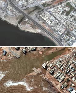
Remote sensing has been used widely to map the effects of conflict, for example determining structural damage to buildings and critical facilities; and damage to transportation networks which in turn may affect humanitarian access.
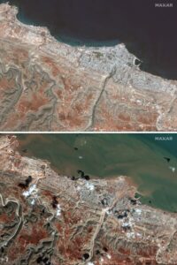
Images acquired using remote-sensing technologies have been employed for monitoring and guiding humanitarian responses to natural disasters including floods, earthquakes, volcanoes, tropical cyclones and landslides.
There are many promising lines of research into humanitarian applications of machine learning on remote-sensing data and there are automated processes developed by companies who are pioneers in using macine learning and AI techniques to use variety of data for humanatarian cases.
