Maximize Yields and Ensure Crop Health with High Frequency Satellite Imaging
Satellite images enables precision digital agriculture and pest detection at scale. By getting access to the daily satellite data helps informed crop management decisions, enabling farmers and agronomists to monitor and maximize their crop health each season.
Satellite image analysis integrated with AI algorithms can be used to assess and understand agricultural production and pattern in order to guide users about famine, maximize market returns for smallholders, and develop tailored insurance policies to mitigate the impacts of crop failures. AI and geospatial technology can be used to predict crop yield and monitor crop health as well, that aims to help users improve their crop yield and to reduce costs. These insights and analytics can be used to:
- Crop and Soil Monitoring – By leveraging sensors and various IoT- based technologies to monitor crop and soil health
- Detect Crop Health Issues – Detect disease, pests, and nutrient deficiencies with dense vegetation analysis and vitality alerts
- Predictive Agricultural Analytics – Various AI and machine learning tools are being used to predict the optimal time to sow seeds, get alerts on risks from pest attacks, and more
- Supply Chain Efficiencies – Use of real-time data analytics on data- streams coming from multiple sources to build an efficient and smart supply chain.
Sustainable practices in agriculture can help regenerate soil health, store carbon, and decrease environmental impacts.
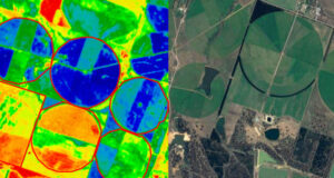
Sustainable practices in agriculture can help regenerate soil health, store carbon, and decrease environmental impacts. Satellite data can help verify adoption of decarbonization efforts, make it easier for growers to optimize their inputs and make more efficient and ecologically sustainable decisions.
